令人惊叹的儿童画报世界地图高清版,将读者带入了终极的环球旅行。真正的为你的孩子编创的儿童地图,采用地图与精美有趣插图结合的形式来展现丰富多彩的世界;对于儿童来说,地图是孩子与世界沟通的一座桥梁。地理知识涉及包括交通、旅游、探险、航空、军事、政治、测绘等众多行业。从小阅读和使用地图,能很好的帮助孩子建立地理空间概念。
A visual atlas that brings the world and its people to life with modern mapping, pictures, facts, and stories, perfect for kids ages 8-12, and fully revised and updated.
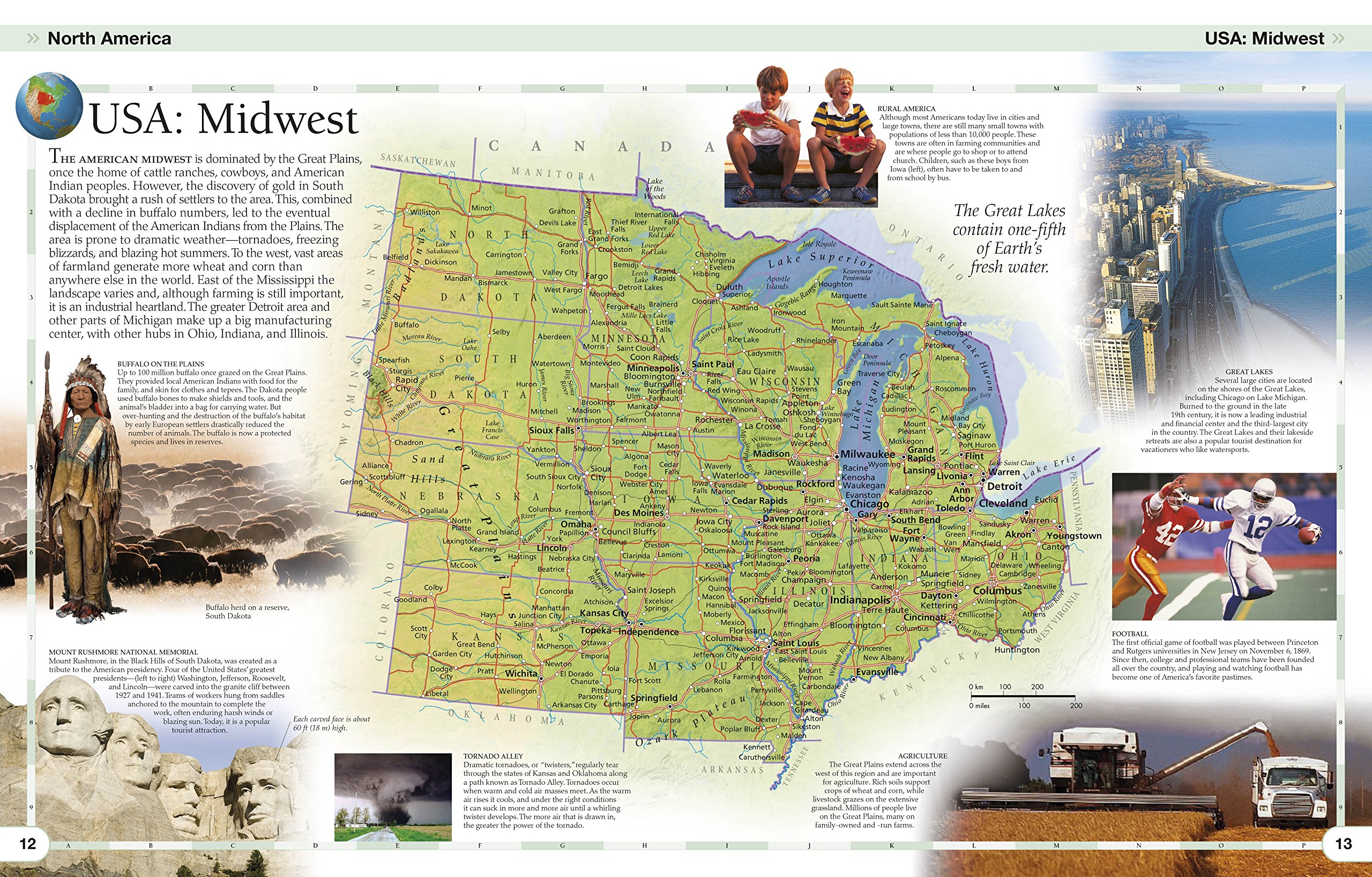
Using modern mapping based on the latest seamless, cloud-free satellite image data, Children’s Illustrated World Atlas takes kids on the ultimate round-the-world trip, from the Americas to Australasia and Oceania.
Each detailed map is accompanied by pictures and stories that explore the society, culture, and history of each region, giving young readers an immediate sense of place not conveyed in standard atlases. Bite-size, country-by-country facts and stats are included at the start of each chapter for additional knowledge, and a place-name index identifies 7,500 locations around the world. Kids will even learn about popular discussion topics such as globalization and the environment in a contemporary introduction section.
Together with facts, maps, satellite images, and local stories, this fully updated and revised Children’s Illustrated World Atlas is a global yet personal experience and brings together views from all over the world—from Bolivia’s bustling markets to carnival in Venice.